
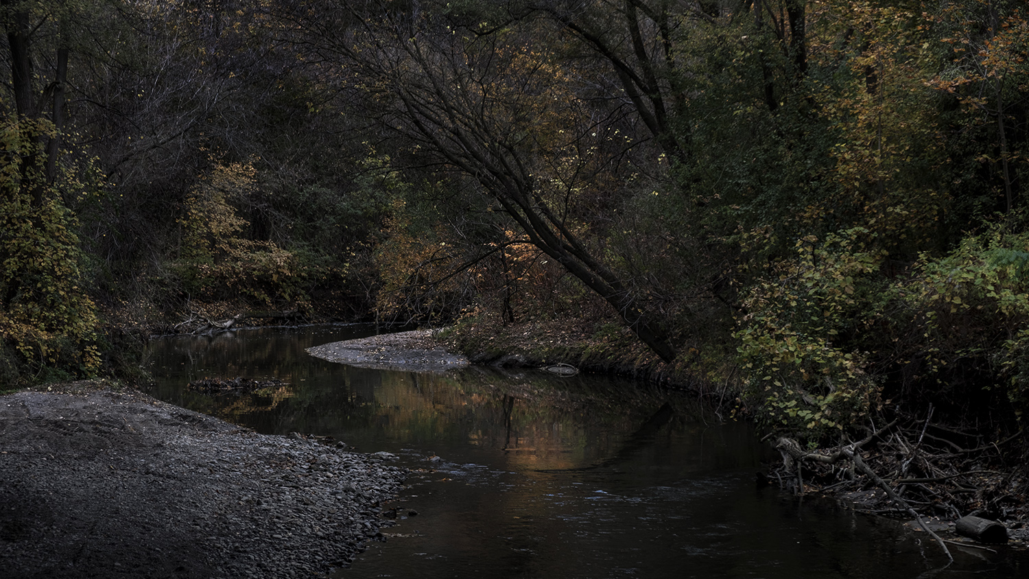
ON A DIM, COOL AUTUMN AFTERNOON WHEN THERE ARE MORE LEAVES ON THE GROUND THAN ON THE TREES it’s hard to believe that the polite creek flowing underneath this bridge can be a raging torrent. But it’s true – flowing serenely between its recently manicured banks of clean new stone, Wilket Creek looks placid. But in the spring or after a rainstorm it can roar and rage all the way down to where it meets the West Don River. Like the wolf that was sighted under a bridge over the creek just that day, the creek is always ready to revert to something wild.

Wilket Creek actually begins north of the city limits and flows in and out of buried channels for much of its length, but the best place to begin following it is on the very lovely grounds of Edwards Gardens. The park is named after Rupert Edwards, a rich man with a green thumb who bought the overgrown lot around a former mill in 1944, building a 9-hole golf course and a lavish garden that he enjoyed for a decade before the city grew up around his refuge, prompting him to sell it on to the city.
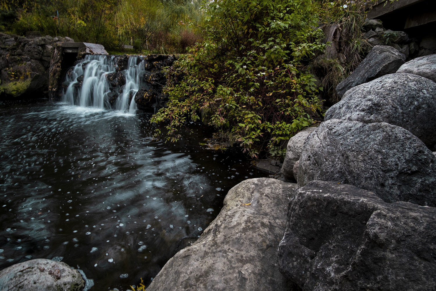
Home to the Toronto Botanical Gardens, the park features lovely landscaped paths as well as a restaurant, an event space and a fine gift shop for gardening enthusiasts. It even maintains its old mill pond, site of the original 3-storey woolen mill built by Alexander Milne in 1827, which contains a rusty mill wheel installed by Edwards to power his irrigation pumps. People have been trying to tame and control Wilket Creek for a long time now.

But that’s easier said than done. There’s a little, nameless tributary to the creek, just by the edge of the Edwards Gardens parking lot and underneath a bridge, not far from the fenced in and overgrown Milne family cemetery. It’s one of many little streams and gullies that flow into Wilket Creek – damp little ravines most of the time, but they combine to fill the creek and burst its banks when the weather is wet.
In 1963 the parkland south of Edwards Gardens was described as “a boy’s paradise,” with tree houses and rope swings over the water. (Today there are water quality signs warning against swimming in the creek.) Milne was only able to run his mill here for just three years, moving east when he found the water levels wildly inconsistent, and his property was allowed to run to weeds for a century. There are very few places that recall that unruly wilderness parkland today, and I’m not sure the city would condone tree houses and rope swings.

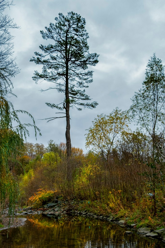
On a day when the clouds are low and heavy, the creek flows coolly over a creek bed punctuated frequently with little bubbling rapids of rocks, the water dark as oil under the fall sky. As with every other waterway I’ve visited in my city during lockdown, the views are the most rewarding when you wander off the trail and onto the dirt paths down to the water.


One hiking website describes the ecology of the creek and its parkland as distinctly watery: “Moist marshes and groundwater seeps that flow towards the creek provide the dampness needed by the ferns, cattail marshes and wet scrub communities along the floodplain.” A lush little island of vivid green river grass echoes this description, and you’re never far away from the sound of gently running water.

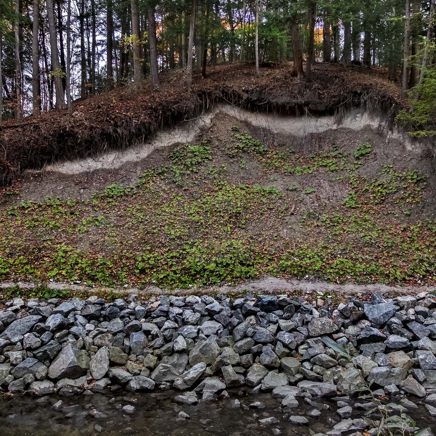
The concrete remains of an old dam, left behind after the recent upgrades to the creek, are a reminder of how useful Wilket Creek was once meant to be, though the millers and farmers who lived and worked here constantly had to repair or rebuild their dams and waterworks. It took effort to make Wilket Creek do its job, and it takes just as much work today to make it a safe and picturesque natural feature in a busy city.

The creek has had several major floods, which led to a comprehensive rehabilitation project that closed parts of the trail over the last few years. It’s a difficult job balancing nature and engineering, so gently curving, naturalized stretches of Wilket Creek will suddenly give way to views where it’s contained between gleaming banks of white stones, the shallow but dark water flowing over manmade rapids of riffle, next to gabion baskets and armourstone walls.

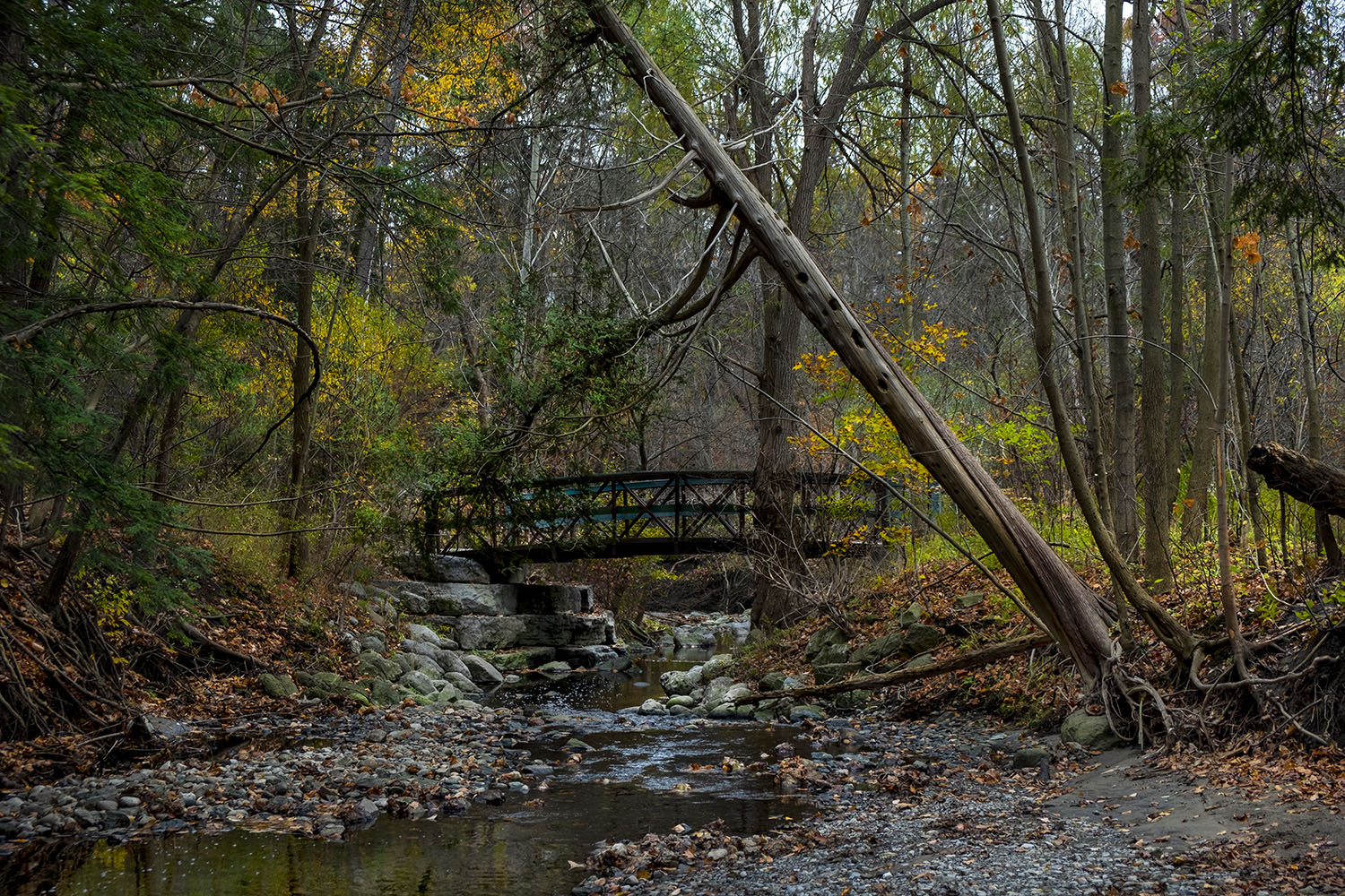
The creek meanders through the park, and its path changed quickly and unpredictably after spring runoff and flash floods carved new banks through the sandy valley floor. There are are nine bridges over Wilket Creek between Edwards Gardens and the West Don river, many of them relatively new, and their existence makes keeping the course of the creek next to the trail managed and predictable an imperative.


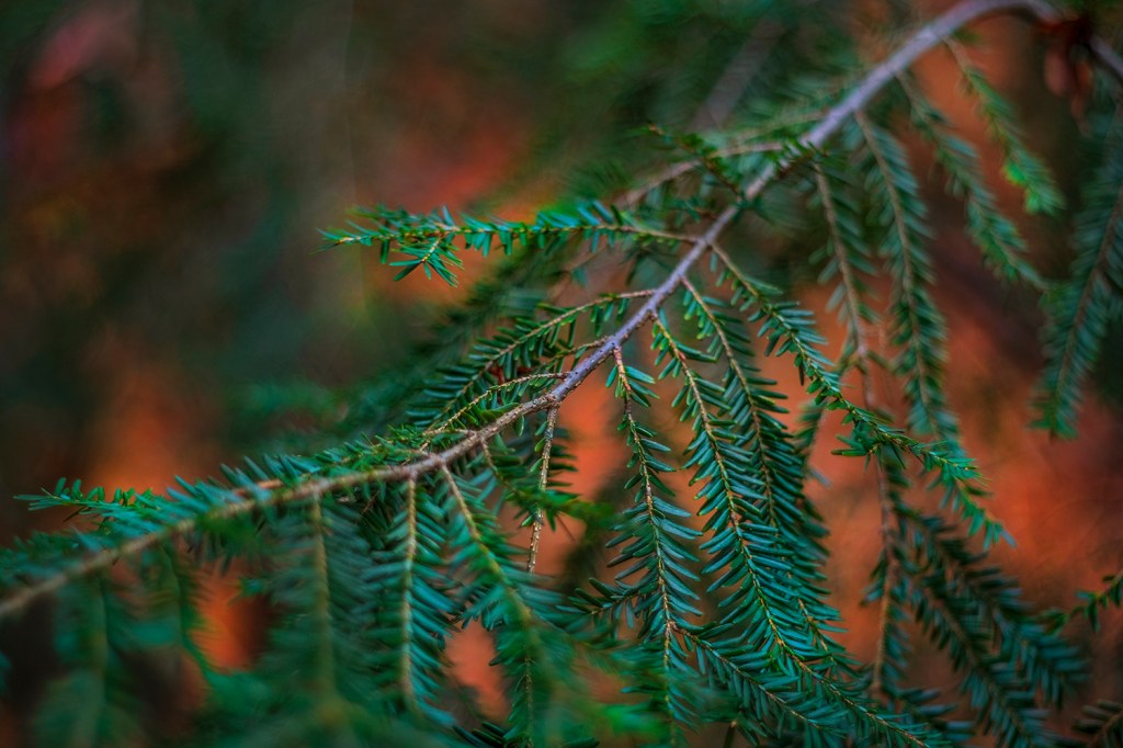
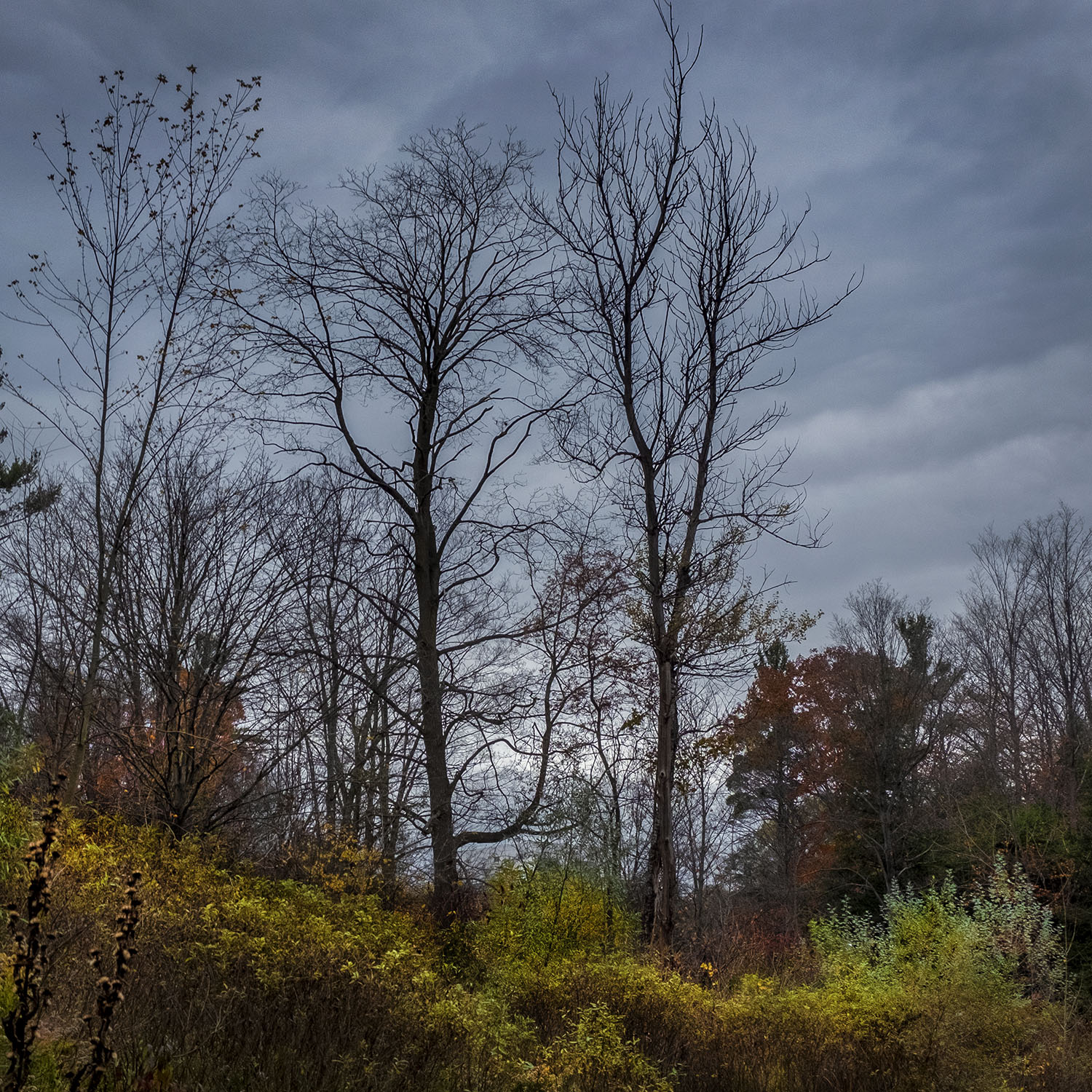
THE FALL COLOURS ARE FADING FAST on this day in late October, which makes their beauty even more subtle, especially under a cool sky. The forest here is remarkably varied for a city park, with Eastern Hemlock, Black Cherry, Sugar Maple, American Beech, Red Oak and Hop Hornbeams bare now against the clouds or barely holding on to their last red and yellow leaves, while the evergreens emerge from the background to dominate the landscape with the only colour that will abide through the coming winter.


This stretch was naturally known as Milne Creek from around the War of 1812, when Alexander Milne bought the land, till the 1950s, when Rupert Edwards sold his gardens and golf course to the city. A quick look at the maps revealed that it was actually the same waterway that flowed through land up near Willowdale, bought by the Wilcott brothers, Paul and Jonathan, in the late 18th century. Misspellings saw it referred to locally as Wilcot, Wilkot and eventually Wilket Creek, and the need to give it a definitive name meant nobody was satisfactorily remembered for posterity.

In some parts of the world, Toronto’s rivers would barely be considered worthy of the name, and its creeks could hardly be described as much more than streams. That’s fair enough on a day like today, when Wilket Creek is low and calm, and the only dramatic thing to be seen is the heavy, darkening sky at the end of a shortening day. But if you know the story of our constant battle to manage and control these waterways, the drama reveals itself to be an unspoken but constantly looming threat.
Wilket Creek ends quietly, draining into a bend in the West Don River, underneath a low roadway bridge by the public washrooms, near the Leslie Street entrance to the park. I didn’t even notice it was gone until I found myself at the end of my hike, walking next to the Don where it passes under the deep shadow of the Eglinton Street East bridge, not far from where I started another hike a couple of weeks before, chasing fall colours down the West Don to Taylor Creek.

Photos and story © 2020 Rick McGinnis All Rights Reserved
