
ROUGE NATIONAL URBAN PARK IS THE ONLY CANADIAN NATIONAL PARK IN A CITY. That it took me as long as it did to finally make it out there can only be explained by its location – all the way across town, on the edge of Scarborough, at the end of over ninety minutes travel by public transit. It takes less time to travel to another city, and in many ways that’s what the east end has always seemed to me.
The Rouge gets its name from the Rouge River, the easternmost of the trio of rivers that define Toronto and create its boundaries. The park, created as a national park just five years ago, is huge by urban standards – nearly sixty-three square kilometres stretching from the lake to Steeles Avenue, projected to grow to nearly eighty kilometres when the park expands to planned borders. There’s no way I can see all of it in a day, and probably not even two or three, so I have to choose my hike carefully.
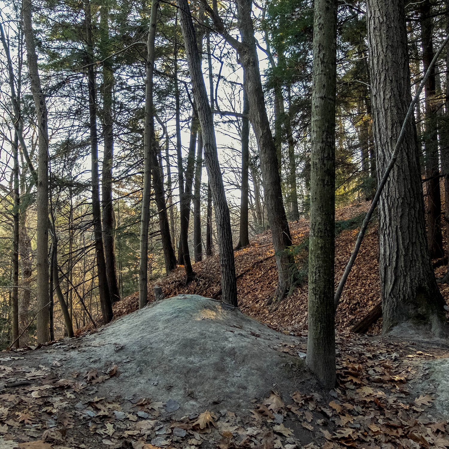
There are fifteen trails running through the Rouge, ranging from a few hundred metres to the more epic Monarch Trail, nearly eight kilometres long. I decide to take the Mast Trail, described on the park website as “classic”, running from the (closed for lockdown) Glen Rouge Campground on Kingston Road and considered a moderate five kilometre loop.

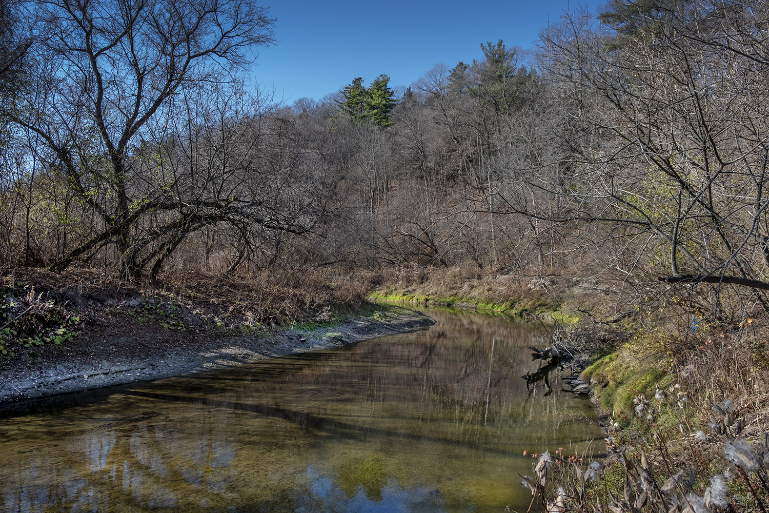
The trail begins where the Rouge River and its tributary the Little Rouge Creek meet, and rises up and down along a hog’s back ridge nearly a hundred metres high, bounded on either side by the river and the creek. Except for a couple of grassy areas near the water, it’s heavily forested, the tall, straight pines once logged and exported to Europe for shipbuilding.

The Rouge is part of the Carolinian forest ecosystem, a mostly decidious woodland that stretches along the eastern seaboard from Carolina all the way to southern Ontario, and the park is the only relatively undisturbed remnant of that wilderness within the Toronto area. It was logged and farmed, but it was never developed, so the Rouge is as close as you get to forest primeval in my neck of the woods.

Most of my lockdown hikes since the summer have been based around a river or a creek, but the Mast Trail quickly leaves the river valley, and for most of my hike I can only glimpse the water, curving lazily, through the trees. Alone among Toronto’s waterways, the Rouge has never been channeled or diverted, and is allowed to flood regularly. It also has the best water quality of all of the city’s rivers, though that’s at the mercy of nearby development, a few old landfill sites, and nearly two dozen golf courses.
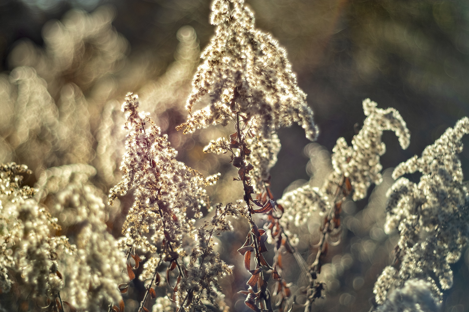

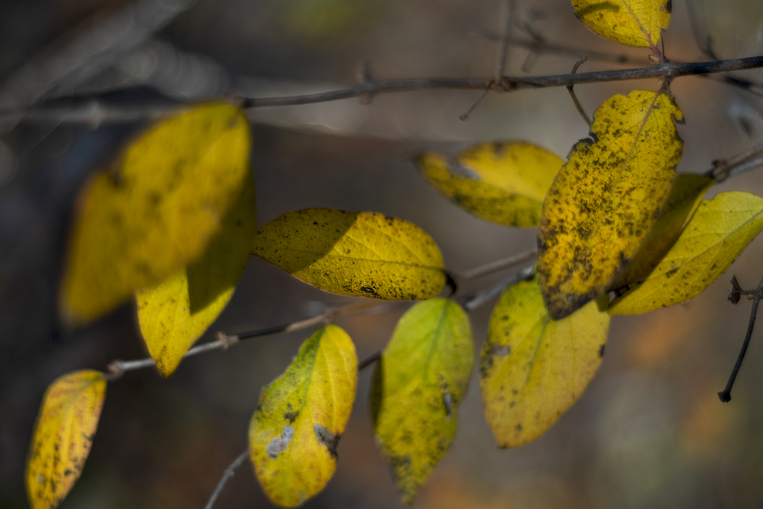
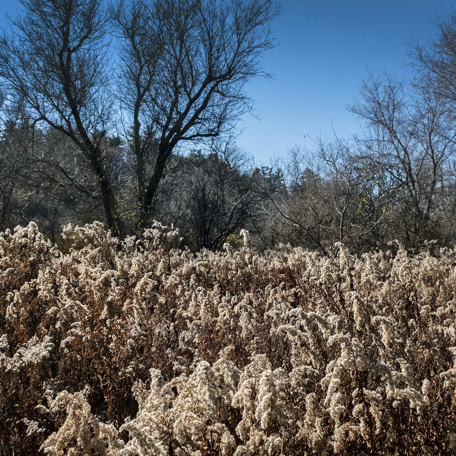
It’s late autumn now, and the colour has almost completely disappeared. Wildflowers that once bloomed along the trails have gone to seed, like the goldenrod backlit by the low afternoon sun. Milkweed pods have burst open and a few yellowing leaves cling to the low shrubs by the water. The weird beauty of this time of year has to be glimpsed up close, in macro, with the hard light from short days behind it.


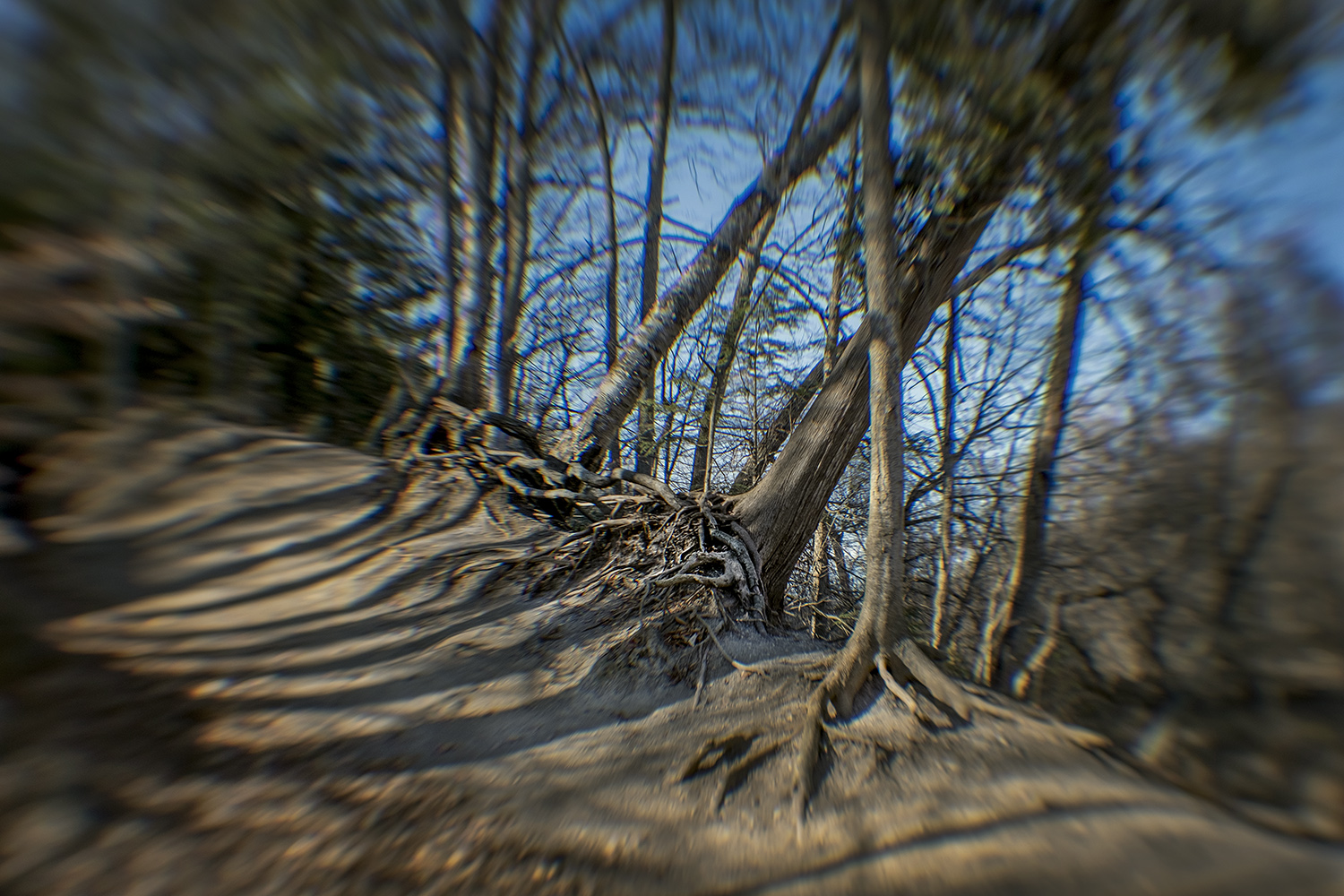
With most of the trees bare now, it’s easier to appreciate their fantastic shapes, whether in jagged ruins or silhouetted against the cloudless sky, a tangle of dark limbs twisting as if reaching for the setting sun. Leafless and seeming to brace themselves for the oncoming winter, it’s easy to glimpse the frozen chapters in the life cycle of these forest giants, played out with imperceptible slowness.

Alone on the trail – the Rouge is hardly deserted, but the path is long and you can sometimes enjoy the precious solitude for minutes at a time – the forest feels enchanted. The shadows lengthen and pick out colours you’d ignore in the hot flush of summer. It’s a bit of a fairytale landscape: deep woods our ancestors would recognize, places of labour and refuge and even danger – a primal place.

The path on the loop back hugs the side of the ridge overlooking the river valley, a steep drop cushioned only by a thick carpet of leaves and whatever hides beneath that. The Rouge is rich in wildlife – there have even been bear sightings recently – but apart from the busy black squirrels rustling through the dry leaves, my afternoon on the trail is mostly about the cathedral-like woods and the sharp, cool fall air, only occasionally soundtracked by the low roar of the cars on the express lanes of the 401 just to the south.


It doesn’t take long for the sun to sink and the shadows draw long lines across the trail. I make a promise to myself to return to the Rouge next year, in the spring, to explore the meadows and onetime farmland by the trails north of the Mast. I won’t lie – 2020 has been a bad dream. I can’t wait for the end of lockdown and the return of travel, but if the year has given me one gift, it’s the chance to really explore my hometown, for the first time ever. The next time someone in some foreign place asks me what’s worth seeing in Toronto, I might actually have an answer.


Photos and story © 2020 Rick McGinnis All Rights Reserved

Great shots, Rick.
LikeLiked by 1 person
[…] as varied or rampant as it is, say, out on the Leslie Street Spit or conservation areas like Rouge Park, but each of the islands, from populous ones like Ward’s and Algonquin to tiny or isolated […]
LikeLike