
TORONTO’S OTHER BEACH DOESN’T GET NEAR THE SAME ATTENTION AS ITS EASTERN ONE. Known definitively as “The Beach” or “The Beaches” depending on how old you are, the city’s eastern waterfront is picturesque, a long wide stretch of sand that starts right at the edge of a quaint – and expensive – neighbourhood of pretty old houses. If Toronto was a continent, The Beaches would be California, mellow and full of summer’s eternal promise.
The western beaches, on the other hand, are full of breakwaters, parks, boardwalks and marinas, and only one stretch of sand to speak of, with water whose safety for swimming varies depending on official city health warnings. Hardly a homogenous beachfront attraction, it actually comprises at least a half dozen discrete areas, each one unique, and with their own long, sometimes troubled and even uncertain histories. Still, it’s the beach that means Toronto to me.
A visit to Toronto’s western beaches begins at an amusement park – one of three, though only one is still operating. The Canadian National Exhibition grounds have hosted Toronto’s annual summer fair on this site for a century and a half, and have filled the spot with a variety of buildings, though the loveliest of the CNE’s facilities, most of them in the southwest corner of the 192 acres of Exhibition Place, haven’t been used by the fair in years. One of these is the Ontario Government Building, a lovely beaux-arts building opened in 1926, and now home to the Liberty Grand, an event space.

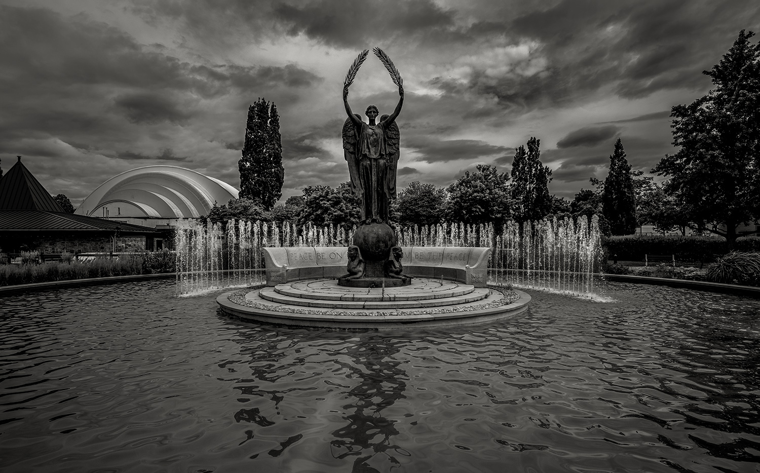
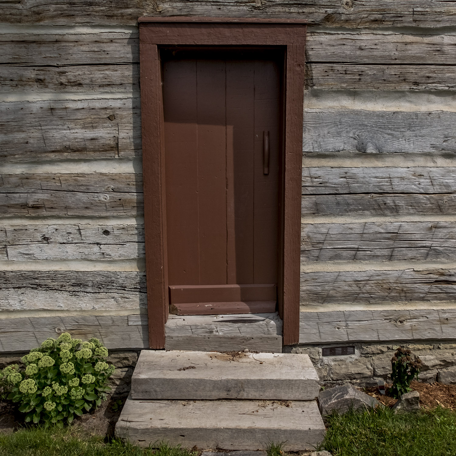
Other CNE landmarks you’ll pass on your way down to the lake include the art deco Bandshell, Scadding Cabin (the oldest surviving building in Toronto, from 1794) and the Shrine Peace Memorial, a memorial to the peaceful relationship between Canada and the United States, built and dedicated by the Shriners and dedicated in 1930, on the spot where American troops apparently landed during the War of 1812 before the Battle of York. Even when the CNE is running at the end of the summer, this is the quietest spot on the grounds; on a midsummer day, or near the end of fall, it’s practically deserted.
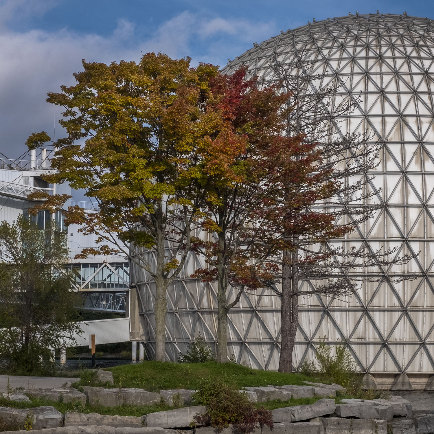

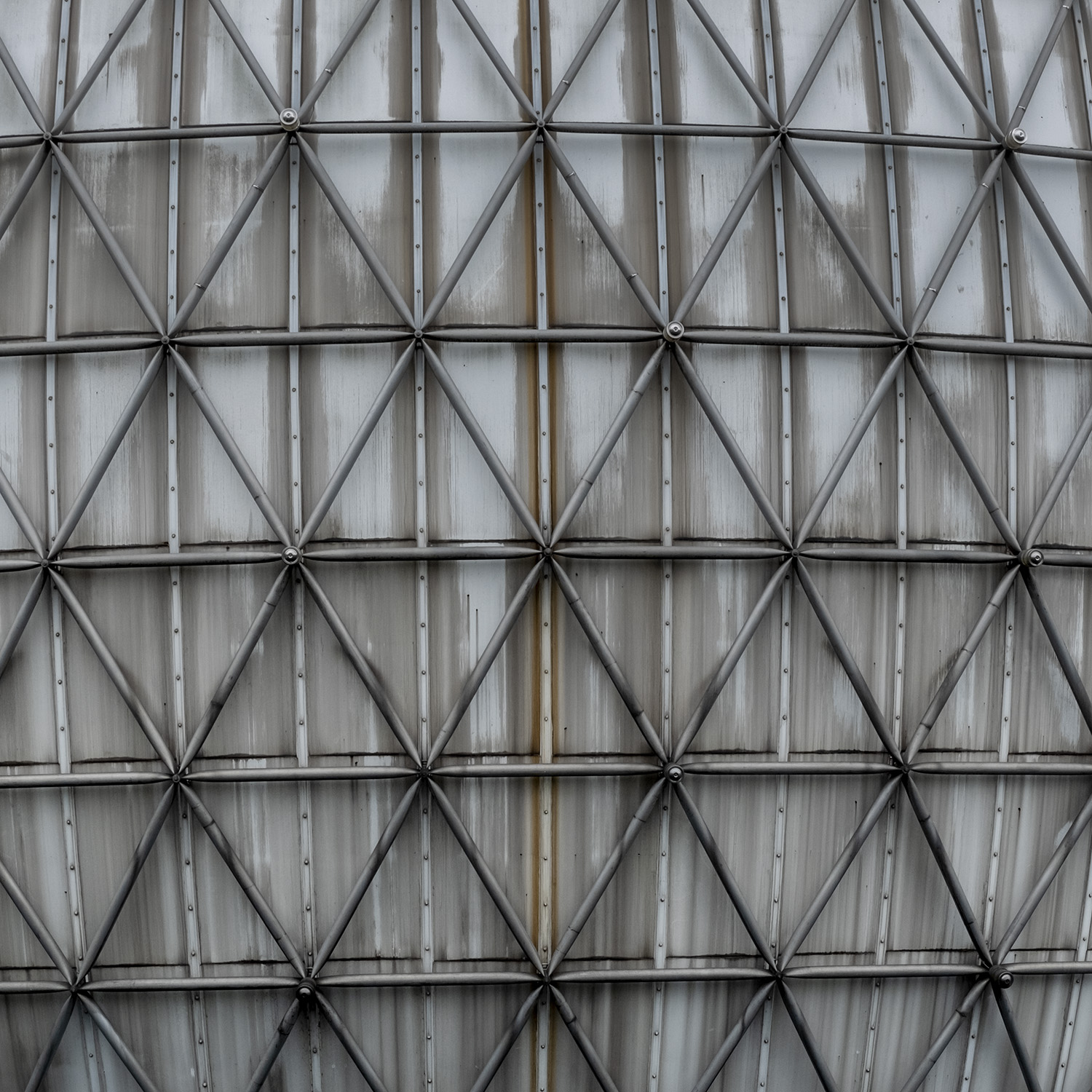
Crossing a bridge over Lake Shore Boulevard you arrive at Ontario Place, a public park built around islands made of landfill. Opened in 1971, it was the province’s response to the runaway success of Montreal’s Expo 67, and the futuristic architecture of that world’s fair was copied by architect Eb Ziedler, who designed the pavilion “pods” held up on piers over the water, joined by glass-walled walkways. They even copied the geodesic dome at Expo 67 (built as the American Pavilion) with the Cinesphere, a cinema built to showcase new IMAX technology. Today it’s an evocative example of retro-futurism – what the future looked like in the 1970s, like a set from Logan’s Run or Space 1999.

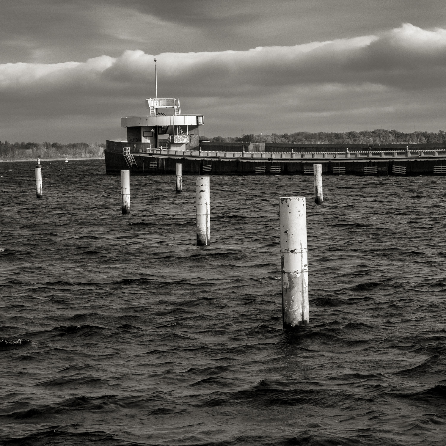
The whole complex was built to replace the Ontario Government Building just north on the CNE grounds, and when it opened it included the Forum, a revolving concert stage, a marina, restaurants, shops and a children’s area centred around a massive, roofed jungle gym. A retired lakeboat was sunk to provide a breakwater.
Ontario Place struggled from the start, though, and by the ’80s Ziedler’s pavilions were closed to the public, becoming a private event space renamed Atlantis. The Forum concert venue was demolished to make way for the more conventional Budweiser Stage, and finally the children’s area – the raucous destination of countless school trips and family outings for two generations of kids – was closed, replaced with a water park, while a log flume ride was built on the other side of the site.

In 2012, citing persistent budget shortfalls, the province closed down all of the amusement park sections of Ontario Place, including the log flume – a fairground ride built with an educational component, meant to teach children about resource extraction and logging in the province. Many of the areas shut down by the province had only been opened or refurbished two years before.
Most of the grounds have been repurposed into more passive parklands; during COVID lockdowns, the province moved in fire pits, chairs and benches and opened an outdoor stage with socially-distanced areas marked in paint on the ground, for families and groups in the audience to gather safely, near what was once an area of restaurants and shops. Public art was put on display around the paths and waterways. The flume ride, however, is still mostly there, slowly falling apart, and a magnet for urbex and urban ruin enthusiasts.

The Cinesphere was re-opened in 2017, screening big-budget films and IMAX features on the weekends, and the Budweiser Stage hosts a summer concert series. But the future of Ontario Place is still very much in doubt, as the province has put forward several plans, all of which have met with public protests against leasing large sections of the islands to private companies to build and run waterparks, restaurants and even a luxury spa. Having lost money on Ontario Place for most of its history, the government is intent on finding a way to at least break even, while the public – many still angry about the sudden closure of the amusement park attractions – is intent on keeping the whole of Ontario Place open to the public.


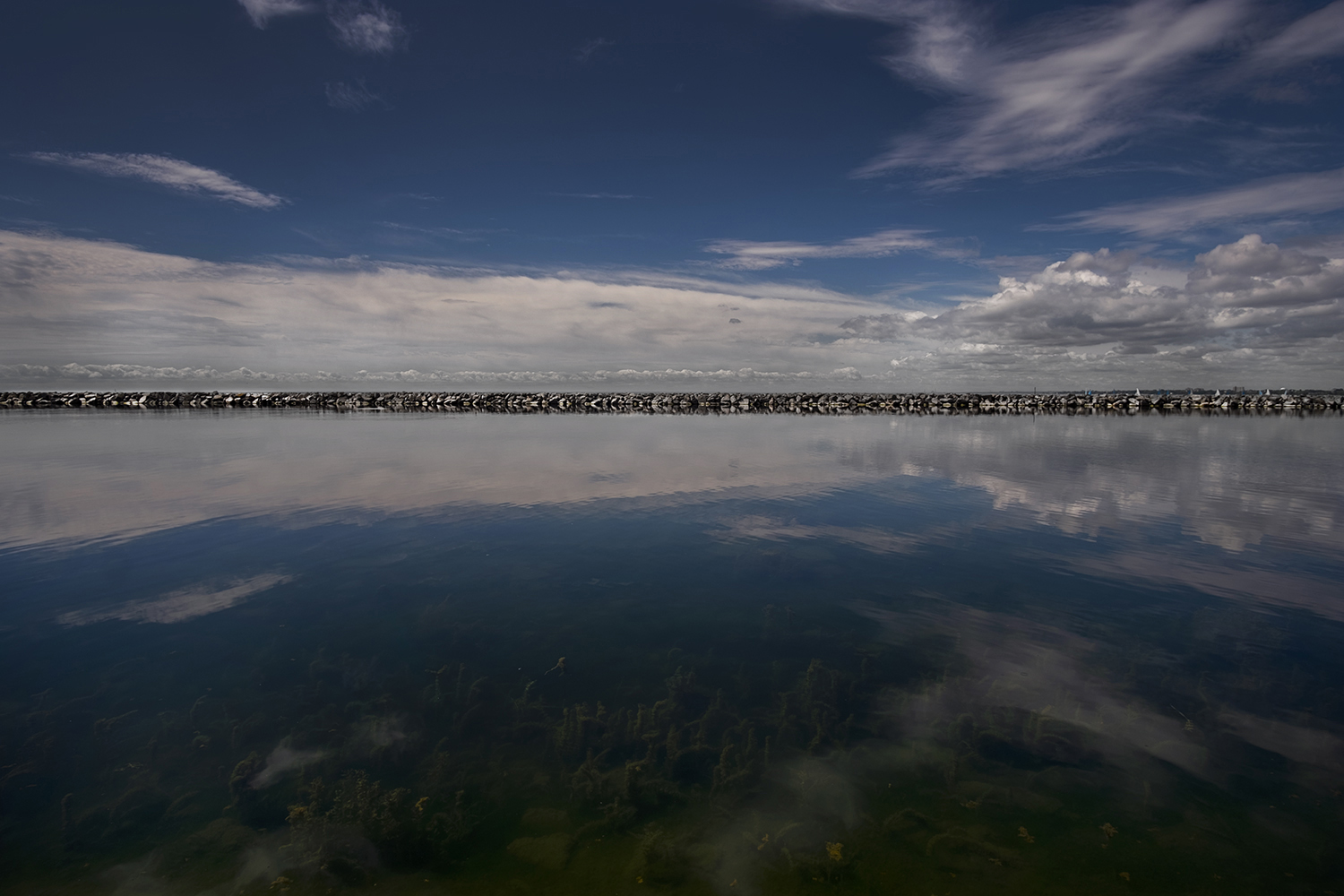
Ontario Place is the beginning of a long breakwater that runs parallel to the western shore, all the way to the mouth of the Humber River. Marilyn Bell Park begins just west of Ontario Place – a long strip of parkland between the water and Lake Shore Boulevard West, named for the 17-year-old who, in 1954, was the first person to swim across Lake Ontario. The boardwalk here hugs the lake, and though the park opened fifteen years ago, the boardwalk and its pedestrian-friendly landscaping are only seven years old.

The park, built where Bell came ashore after swimming across the lake from Youngstown, NY, is rarely crowded, and a great place to watch rowers from the nearby Argonaut Rowing Club practice in the shelter of the breakwater. The boardwalk ends at the rowing club, and your hike will have to move to the Martin Goodman Trail, a shared bike and pedestrian path that runs along most of the waterfront. The trail takes you past Royal Canadian Legion Hall Branch 344, the private Boulevard Club and its tennis courts, and the sailboats moored along the breakwater.

It’s a remarkably under-used section of the western beaches, because most people don’t know that it’s there. Access to this part of the waterfront for pedestrians involves a walk down from King Street West to a trio of bridges that cross railway tracks and the Gardiner Expressway before reaching Lake Shore Boulevard. It’s apparently an obstacle that people are either unaware of or are unwilling to bother with, preferring to make their way to the western beaches across the pedestrian bridge by the intersection of King, Queen West and Roncesvalles, near the former location of a railway station.
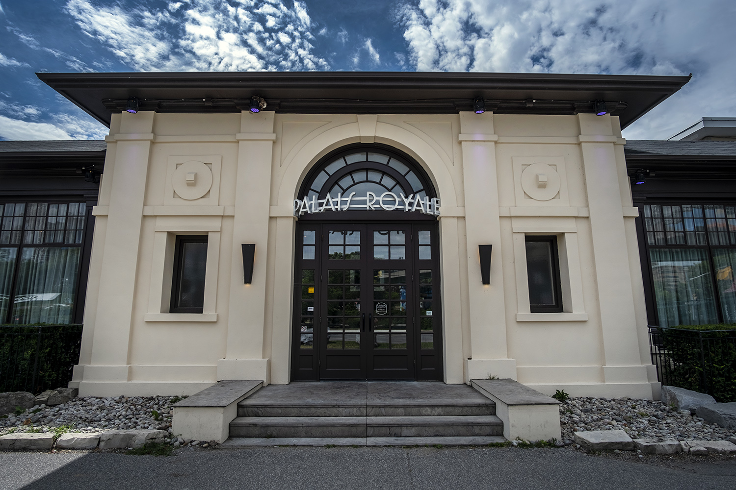
The Palais Royale ballroom sits at the end of that pedestrian bridge. Built in 1922 by Chapman, Oxley & Bishop, the same firm that designed the Ontario Government Building at the CNE, it was originally Dean’s Sunnyside Pleasure Boats, a boat builder and rental company famous for their lake canoes. The dance hall upstairs was something of an afterthought, but it quickly outlived Dean’s, and by 1932 the Palais Royale became one of the city’s premiere dance halls, just in time for the birth of swing. Touring bands such as Duke Ellington, Count Basie, Eddie Duchin, Paul Whiteman and the Dorsey Brothers played there, and it was the home base for Toronto’s own Bert Niosi and his orchestra – Canada’s “King of Swing.”
The Palais Royale managed to survive the end of the swing era, and by the ’70s it was a rental hall for concerts. I saw UK’s The Specials there in 1980, much to the delight of my mother, who used to go there to dance over three decades previous. The Rolling Stones held a concert at the Palais in 2002, and often rented the hall to rehearse for tours. The city took ownership of the property by the ’90s, and in 2000 leased it to private companies who renovated the hall and rebuilt its lakefront patio, reopening it in 2006 as an event space.


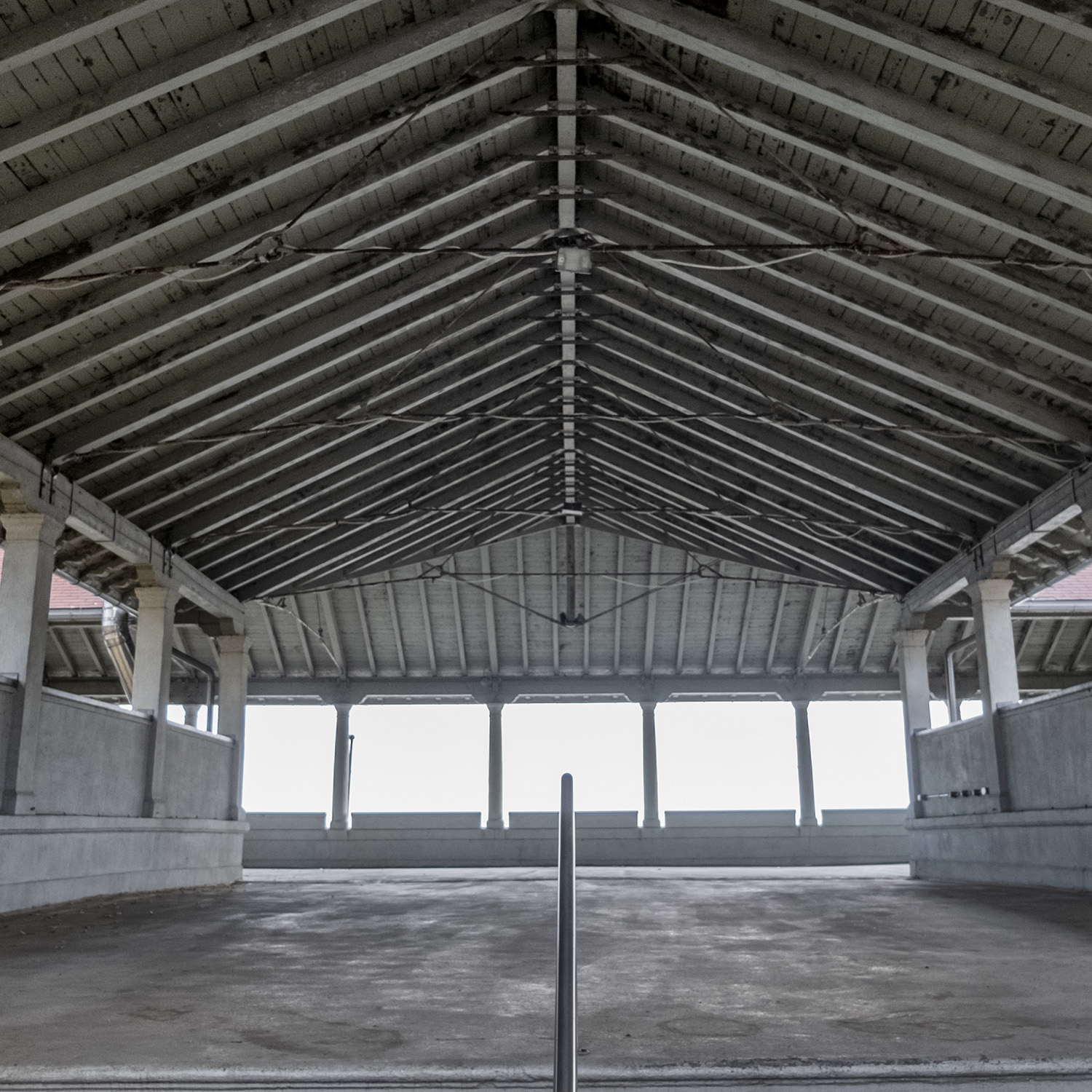
The boardwalk resumes again just to the west of the Palais Royale, by a pollinator garden planted next to the water. The only real stretch of sand begins here, at Sunnyside Park, which got its name from another amusement park that operated here from 1922 until it was demolished to make way for the Gardiner Expressway in 1955. Sunnyside was the pleasure garden for the working class west end, a popular summer destination that featured a softball stadium, a rollercoaster and other fairground rides, restaurants, night clubs and a carousel that was sold to Disneyland when the park closed.

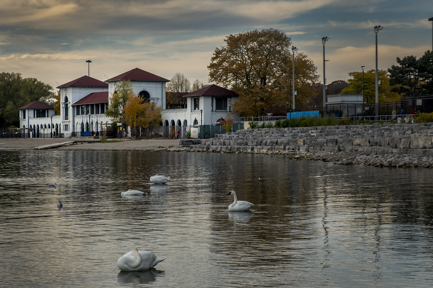
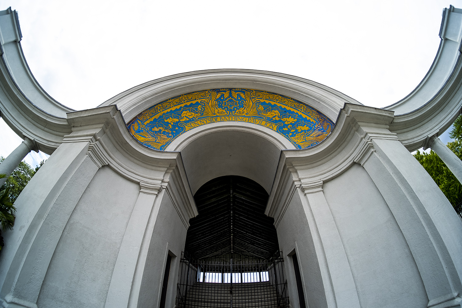
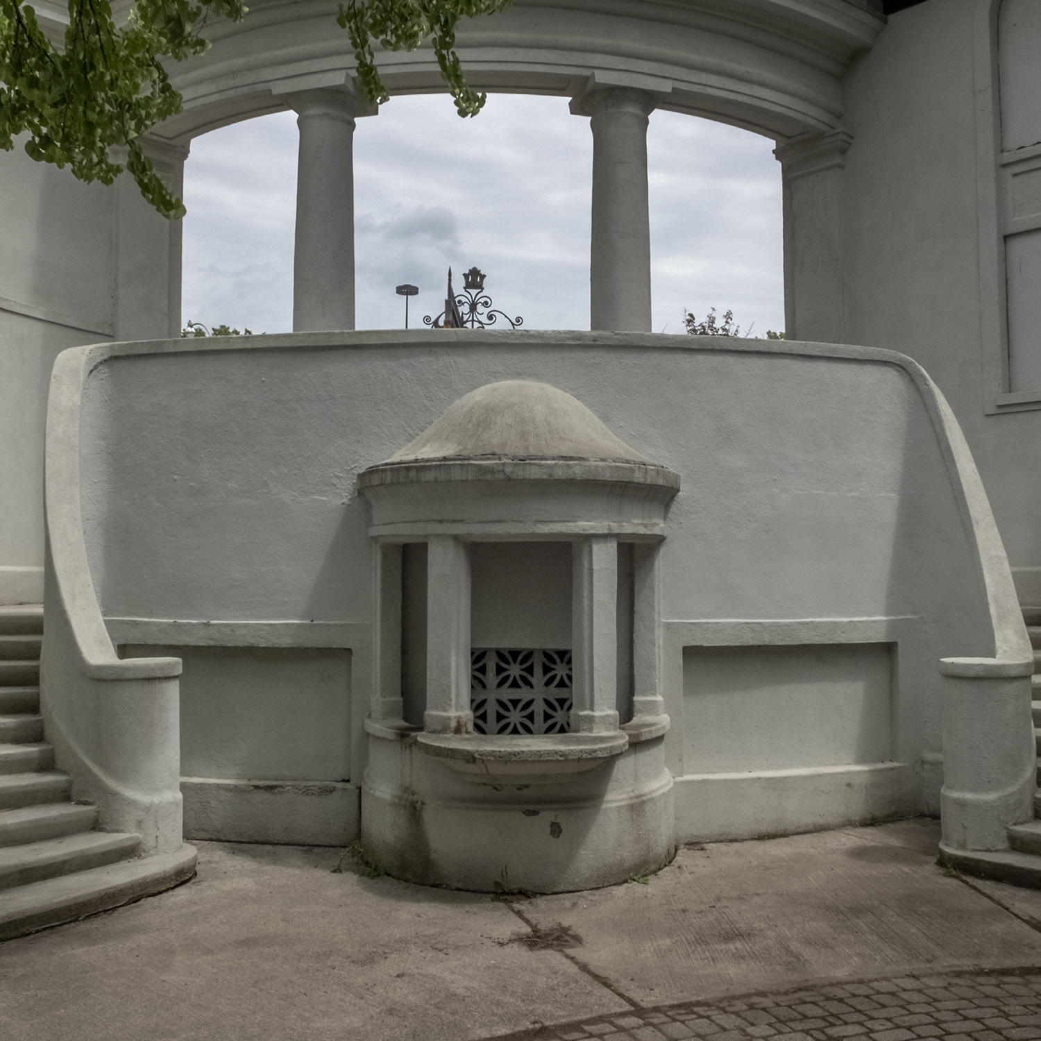
The only other remnant of Sunnyside besides the Palais Royale is the Bathing Pavilion, built – like the ballroom and the Ontario Government Building – by Alfred Chapman of Chapman & Oxley and opened in 1922. With its adjacent swimming pool and change rooms for Torontonians unwilling to risk a swim in the lake, it’s a century-old west end landmark. In 1980 the men’s and women’s change rooms were combined into the east wing of the building, and the men’s changing room in the west wing was demolished to create a patio and garden, where a seasonal restaurant opens every summer. The upper level of the Pavilion, once very popular for photo shoots and music videos, is now closed to the public for use as (you guessed it) a rental event space.
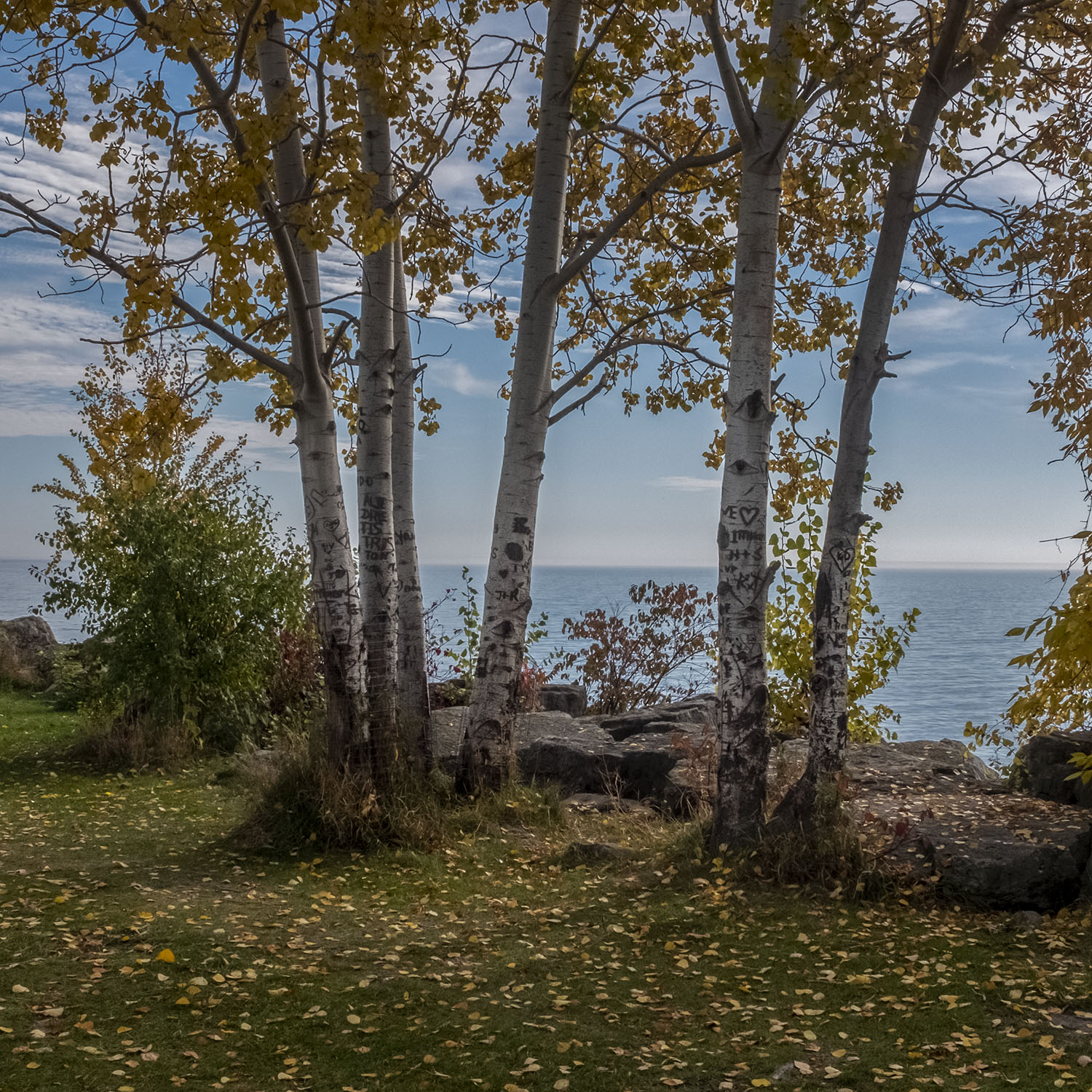
Past the bathing pavilion Sunnyside Park becomes Sir Casimir Gzowski Park, named after one of Toronto’s most illustrious and eccentric early citizens. (A penniless Polish aristocrat when he arrived in Canada, he made his fortune as an engineer and entrepreneur; his distinctive tomb can be found in St. James Cemetery.) This contains the last stretch of sandy beach on the western shore, along with a monument, dedicated by King George VI and Queen Elizabeth during their 1939 royal tour of Canada.
Originally located on a grassy median at the eastern end of the Queen Elizabeth Way, it was moved to a spot in Gzowski Park in 1975 and re-dedicated by the late Queen Elizabeth II, the daughter of George and Elizabeth, in 1989. The inscription, carved at the bottom of the monument under a lion sculpted by Frances Loring, was finished in August 1940, and hints at the uncertain outcome of World War Two in its first years, pointedly noting that it was finished “in the Empire’s darkest hour in full confidence of victory and a lasting peace.”


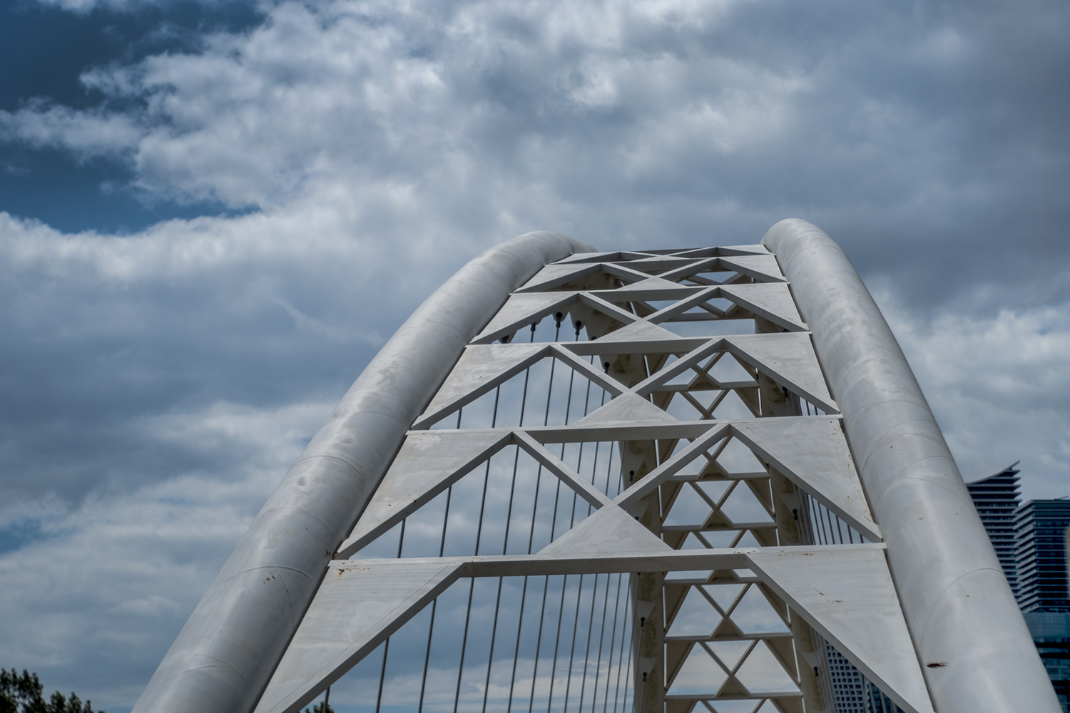
Gzowski Park ends by the mouth of the Humber River, where the boardwalk merges with the Martin Goodman Trail to cross the river over a distinctive bridge. We’ve been here on this blog before, at the end of a hike down the Humber from Bloor Street to the lake; the Humber Bay Arch Bridge was designed by Montgomery and Sisam Architects and opened in 1994, and was one of the city’s most photographed locations long before it became an Instagram staple. The bridge also marks the spot where the waterfront trail moves from Toronto to Etobicoke, a municipality that was incorporated into the city when it was amalgamated in 1998.
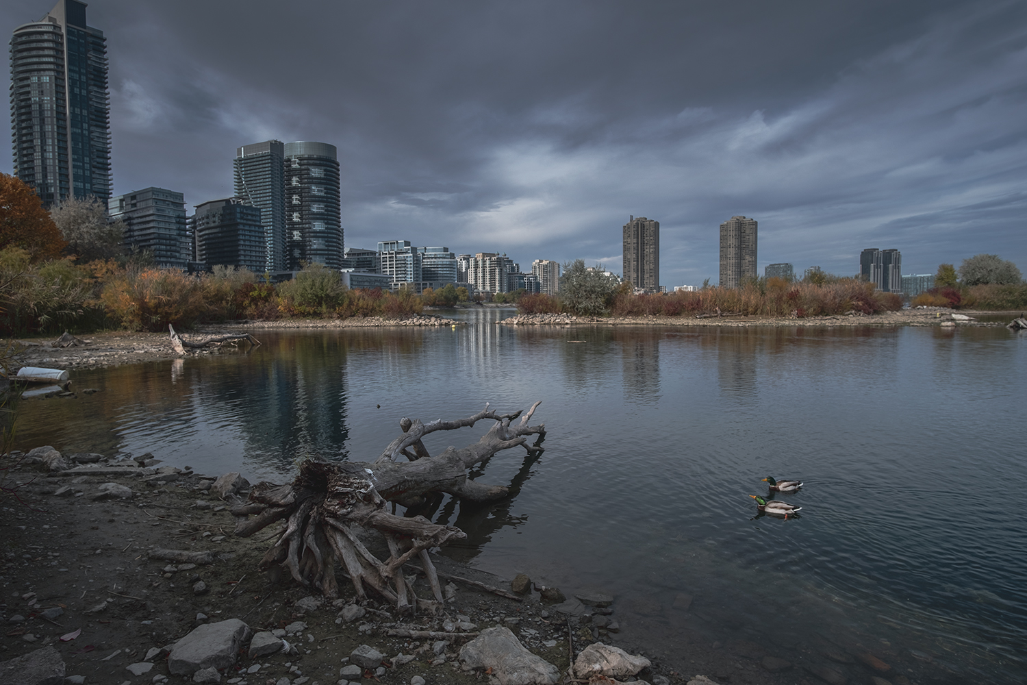
As we’ve made our way along the western beaches toward the Humber, it was hard to miss the looming forest of condominium towers clustered on the far side of the river. The Etobicoke side of the Humber was once home to at least a dozen motels, once reputable but mostly run-down by the ’70s, the last of them demolished ten years ago. What quickly took their place was a new city of condos, and anticipating the leisure needs of a huge – and affluent – new population on the shore of the lake, the city began planning the Humber Bay Parks, two new parklands built, like Ontario Place, Tommy Thompson Park and much of Toronto’s lakefront, with construction landfill.

The parks were built out into the lake on either side of the mouth of Mimico Creek, sculpted to contain ponds, bays and inlets to create habitats for fish and waterfowl, like the warm water basin in the eastern park. Like Tommy Thompson Park in the east end, it’s become a haven for birders, with plenty of spots to see and photograph wildlife, both native and migratory, who’ve become attracted to the parkland since the first sections were opened in 1984.
Walking trails and cycle paths snake all over the two promontories, which have been created and landscaped to provide views across the water. Beaches tend to be made of mud, gravel or man-made shingle – pebbles and small rocks made of construction debris, worn smooth by the water. Like Tommy Thompson Park, the parks are still a work in progress, and part of Humber Bay Park East was closed during my visits to maintain and restore the headlands and shoreline by the lake, which suffer erosion during winter storms.

Mimico Creek is crossed with another arched bridge that’s become a visual trademark for the western beaches. Santiago Calatrava designed the Mimico Creek Pedestrian Bridge in 1996; it was opened in 1998, and its single inclined arch is an echo of the bridge over Humber Bay – so much so that visitors to the park mistake Mimico Creek for the much wider and deeper Humber. (Even Google Maps makes this mistake.)
The creek begins in Brampton, and flows down through Mississauga and Etobicoke to its mouth, a very seasonal stream that runs through concrete channels for long sections to the north of the park, which makes it deceptively shallow when rainfall is low. The construction of the park restored wetlands to the mouth of Mimico Creek, and it’s one of the park’s most active habitats for migratory birds.


The eastern half of the park contains another butterfly and pollinator habitat, as well as the remains of the Palace Pier – a dancehall built on a pier over the lake that once competed with the Palais Royale for crowds. The ballroom was part of what was planned to be an amusement pier, copied from similar ones in British seaside towns like Brighton and Blackpool. Only the dance hall section as built, opened in 1941 and host to big bands, wrestling and boxing matches, religious meetings and school proms before it was destroyed by a fire in 1963.
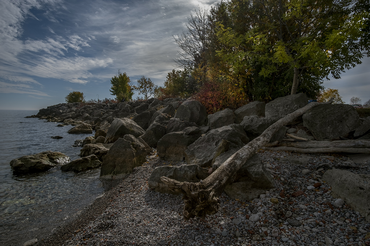
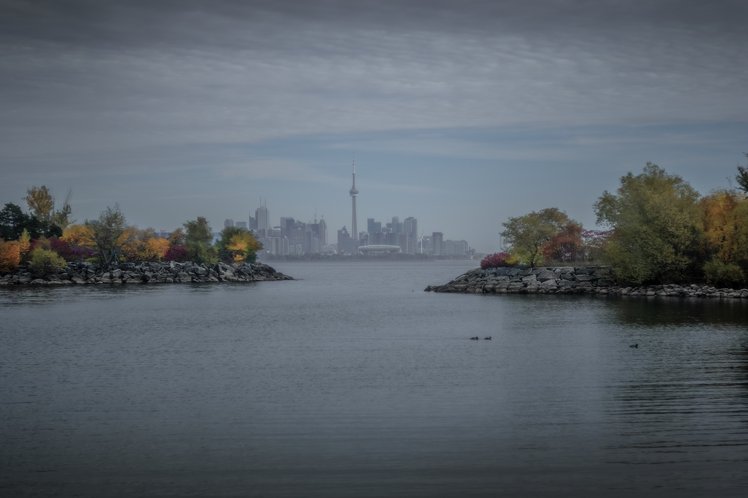
With the outer parts of the eastern park closed, the western half of Humber Bay Park was the best place to enjoy the dramatic views looking east back to Toronto’s skyline. The rocky shores, with their still-maturing landscapes, provide plenty of spots for dramatic landscape photographs in all seasons and weather. A decade ago this parkland was still raw and largely tree-less, so the evolution of these views is constantly changing.

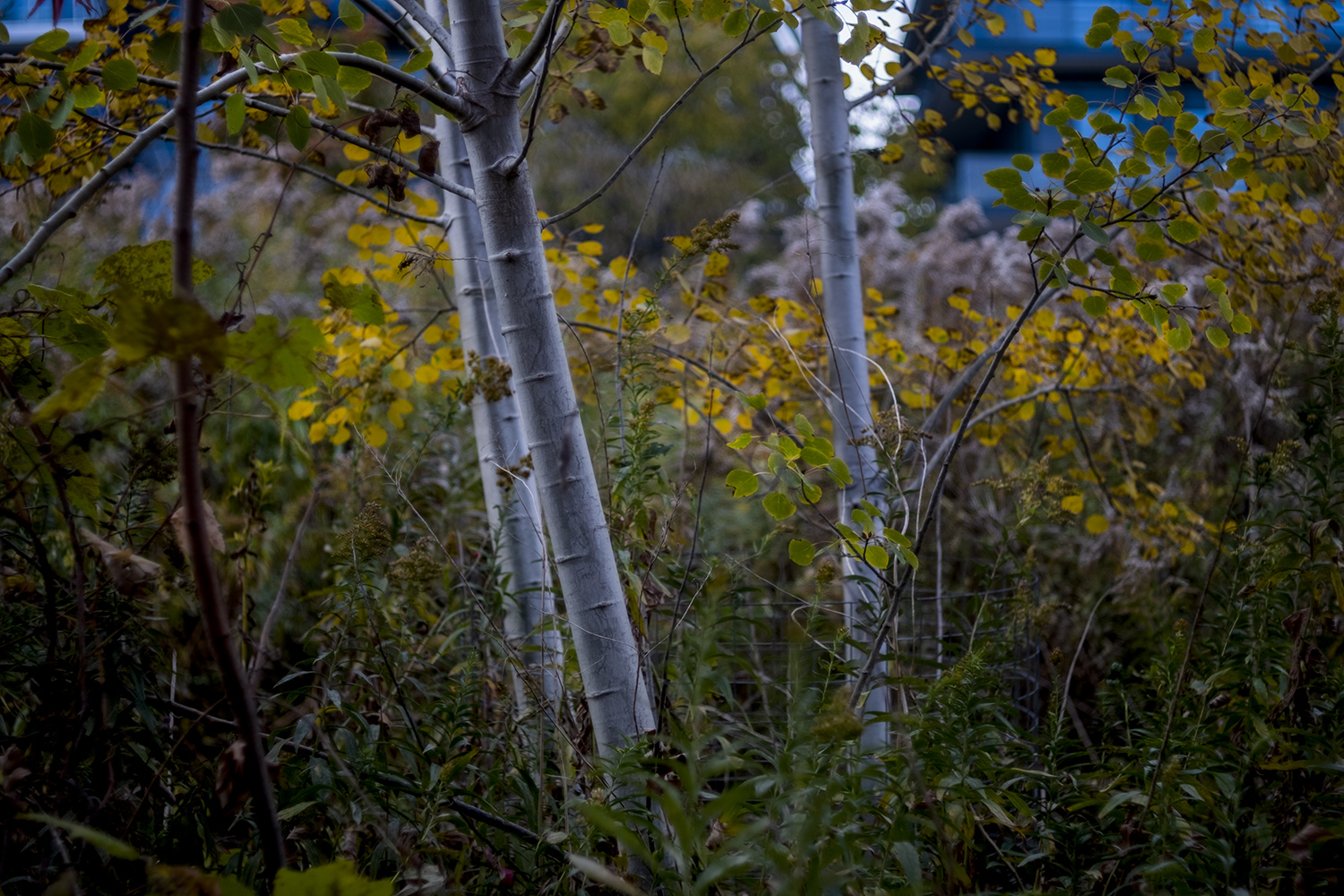
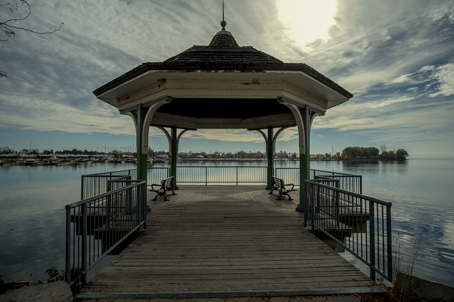
Trails and paths in the parks are mostly paved, but there are a few dirt paths that branch off through the trees, some of them becoming impressively overgrown as the parks naturalize. You have to remember that there was nothing here twenty or thirty years ago, and construction cranes remind us that most of the condo towers on the edge of the park have only gone up in the last decade. The western half of Humber Bay Park contains marinas and boat clubs, and another boardwalk promenade that continues east to Mimico Waterfront Park, though I choose to end my hike at the gazebo built over the water looking across to the Etobicoke Yacht Club.
Photos and story © 2022 Rick McGinnis All Rights Reserved

Excellent write up!
LikeLike
[…] project I’d only just started the previous fall – a post exploring my city’s western beaches, destined for my travel photo blog. I began with a hike along the lake from Ontario Place to the […]
LikeLike